|
|

|

|
Cultural Heritage of Constanta (Romania)
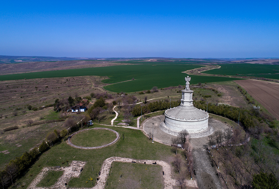
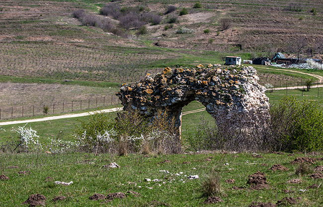
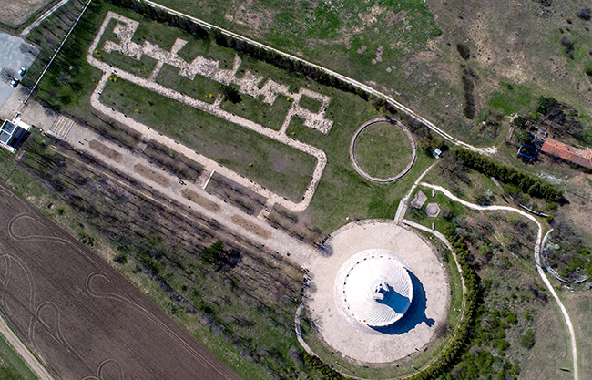
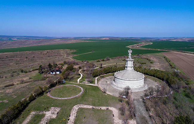
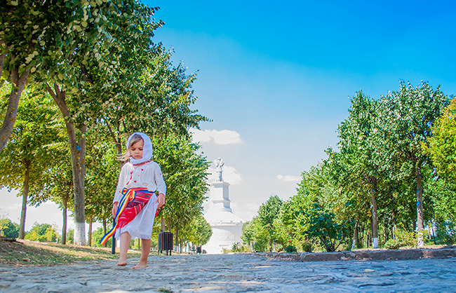
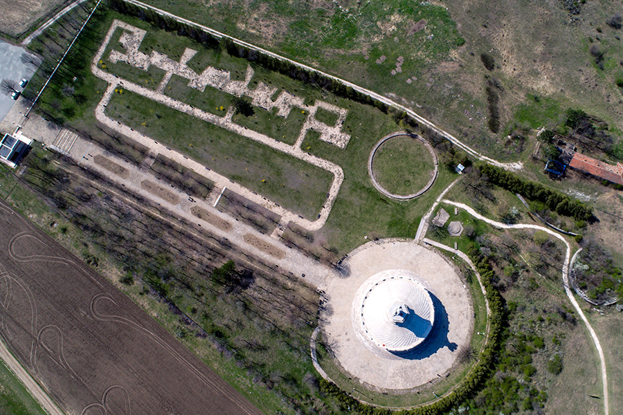
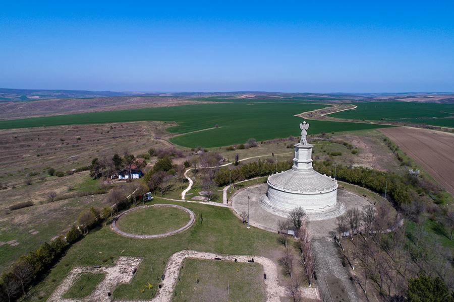
ADAMCLISI MONUMENT
The Tropaeum Traiani is a monument in Roman Civitas Tropaensium (site of modern Adamclisi, Romania), built in 109 in then Moesia Inferior, to commemorate Roman Emperor Trajan's victory over the Dacians, in the winter of 101-102, in the Battle of Adamclisi. Before Trajan's construction, an altar existed there, on the walls of which were inscribed the names of the 3,000 legionaries and auxilia (servicemen) who had died "fighting for the Republic". (Latin: Tropaeum from Greek: Tropaion, source of English: "trophy").
Trajan's monument was inspired by the Augustus mausoleum, and was dedicated to the god Mars Ultor in AD 107/108 . On the monument there were 54 metopes depicting Roman legions fighting against enemies; most of these metopes are preserved in the museum nearby. The monument was supposed to be a warning to the tribes outside this newly conquered province.[1]
By the 20th century, the monument was reduced to a mound of stone and mortar, with a large number of the original bas-reliefs scattered around. The present edifice is a reconstruction dating from 1977. The nearby museum contains many archaeological objects, including parts of the original Roman monument. Of the original 54 metopes, 48 are in the museum and 1 is in Istanbul.
The monument was decorated with a large inscription dedicated to Mars Ultor (the avenger). The inscription has been preserved fragmentarily from two sides of the trophy hexagone, so it could be reconstructed as follows:
MARTI ULTOR[I]
IM[P(erator)CAES]AR DIVI
NERVA[E] F(ILIUS) N[E]RVA
TRA]IANUS [AUG(USTUS) GERM(ANICUS)]
DAC]I[CU]S PONT(IFEX) MAX(IMUS)
TRIB(UNICIA) POTEST(ATE) XIII
IMP(ERATOR) VI CO(N)S(UL) V P(ater) P(atriae)
?VICTO EXERC]ITU D[ACORUM]
?---- ET SARMATA]RUM
----]E 31.[2]
The inscription from the main monument can be translated in this way:
"To Mars, the avenger, Caesar the emperor,
son of divine Nerva, Nerva
Trajan, Augustus, who defeated the Germans,
the Dacians, great priest,
for the 13th time tribune of the plebeians,
proclaimed emperor by the army for the 6th time, elected consul for the 5th time, father of our homeland,
after defeating the Dacian and the Sarmatian armies."
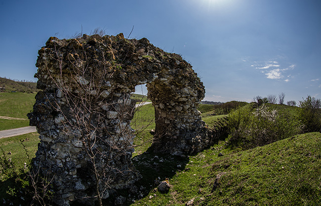
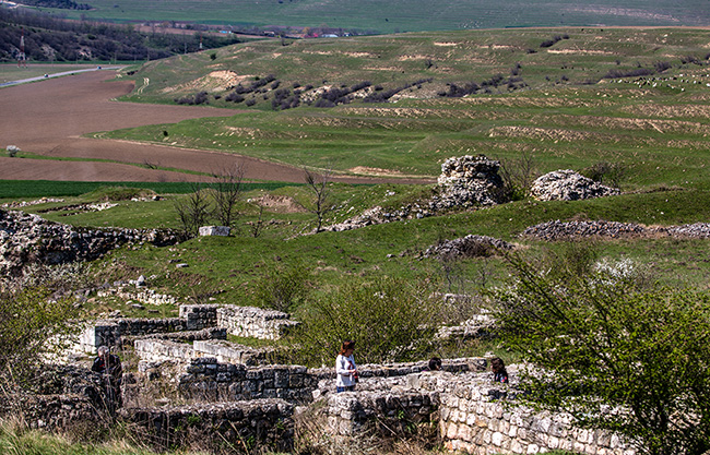
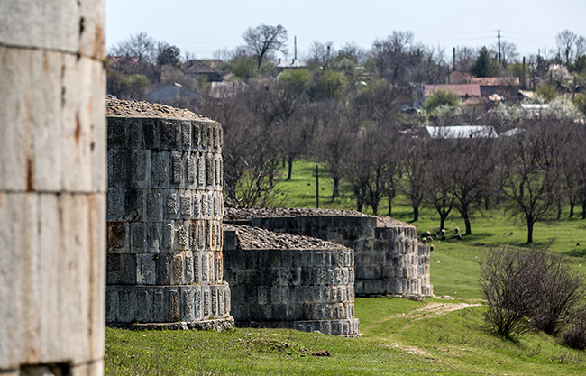
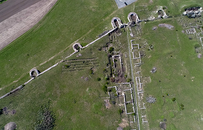
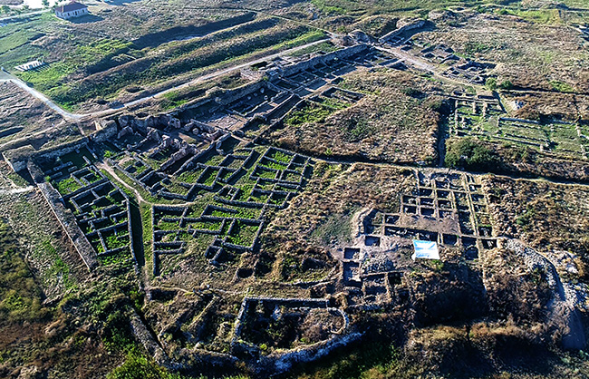
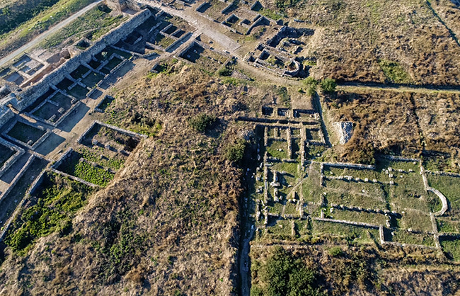
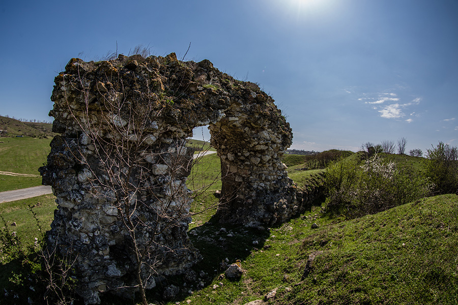
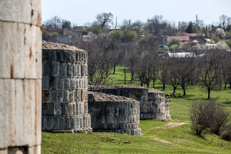
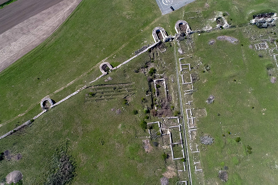
CAPIDAVA
Located on a rocky outcrop in outstandingly beautiful countryside, the ancient fort of Capidava overlooks a forested bend of the Danube, 25km north of Cernavoda. It is square in shape, with well- preserved walls and semicircular towers.
Capidava is Dacian for ‘citadel on the river’s curve’, its name thus remaining unchanged since pre-Roman times. The first Roman camp was set up in the 2nd century AD, although the present ground plan dates to the 4th century AD. Elevated and once surrounded on 3 sides by water, the fort was naturally defensible, one in a line of defences along the Danube on the limit of the Roman Empire. In the 6th century, invasions and an earthquake all but destroyed the fort; a new inner bastion was created for the garrison, and the civilian population moved inside the walls. The fort remained a border post until the 11th century.
Although its outer walls have been fully revealed, along with the inner bastion — a late Roman feature unique in Romania — much remains to be found on the site, and the summer visitor is likely to find ongoing excavations.
The Capidava fortress lies at half the distance between Harșova and Cernavoda. It has been erected during the Trajan ruling at the beginning of the 2nd century a.D. like many other Roman camps and fortresses from the Danube frontier.
This camp is situated on the right Danube shore near a river ford and has been constructed by the following detachments and legions: the V Macedonica and the IX Claudia legion. The Getan toponym (Capidava means 'the fortress from the turning place') confirms a pre-Roman human existence that is also archeologically proved in a settlement of such importance to communication between the Dobruja Getans and the Muntenia Getans. The geographical position of Capidava was very important from a strategical point of view and has determined the settling of a military station as well as the construction of a civilian center nearby during the Roman epoch. The spot chosen for the fortification was the most appropriate : a rocky, peninsular massif surrounded from three sides by the Danube and a natural ditch. The shape of the massif has imposed the shape of the camp: a quadrilateral with its long sides running from the north-west towards the south-east. The eastern part, a narrow promontory gave accesses to the massif and to the fortress. As a military station for almost five centuries the fortress allowed cantonment of a series of troops: cohort I Ubiorum, cohort I Germanorum (2"d - 3rd century); vexillatio capidavensium, cuneus equitum Solensium and cuneus equitum Scutariorum (4,n - 6'“ century). Like the other frontier settlements, Capidava had to confront many barbarian attacks. It so happened that the camp has been destroyed by carpo-Gothic attacks and had to be entirely reconstructed towards the end of the 3"' century a.D. The reconstructed fortress (its ruins can be visited nowadays) has a quadrilateral basis (105 x 127 m) with 2m thick and 5-6 m high walls. There are also 7 towers, 11 m in height; a 2,36 m broad gate on the south-east; a strategic gate on the Danube side of the tower and a terrace harbor. The camp has been attacked, destroyed and then rebuilt several times. During the 6"’ century A. D. after the Huns had burned it down, when probably no sufficient forces existed for a complete reconstruction, a little quadrilateral fort has been erected (60 x 60 m) on the southern part of the former fortress. Archeological diggings have discovered the itinerary of the site wall and also the defense ditch. In the 7"’century A.D. the fortress has been completely destroyed by the Slavic-Avarian attacks and it was deserted by all troops left to survey the area. Due to the reorganization of the Byzantine Empire, Capidava gets again to the attention of the administration. On top of the fortified Roman ruins, a new peasant fortress has been erected, a fortress for the stratiotoi (peasant frontier guards) that will last up to the 11"' century and consists of eleven living platforms, as the successive reconstruction shows. The new fortress was surrounded by a wall of stone and soil, doubled by a defense ditch, both following the itinerary of the Roman-Byzantine site. The visiting route goes around the fortress along the site wall from west to east; ruins from a Roman-Byzantine construction can be seen inside the fortress on the right side: store houses, living houses, a hypocaust etc. The fort lies on the left side of the fortress and its adjacent buildings. Towards the North there are some feudal mud-huts where those stratiotoi have lived. Behind the site wall a Christian basilica can be seen dating from the 5“' - 6'b century A.D. The thermae can be visited on the plateau in front of the fortress entrance. The highly diversified pieces found in the fortress and its surroundings are exhibited in the Museum of National History and Archeology in Constanta.
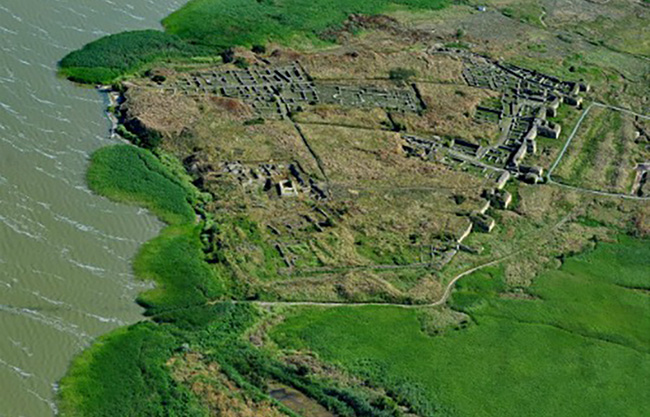
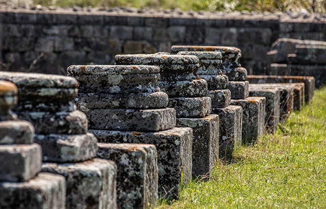
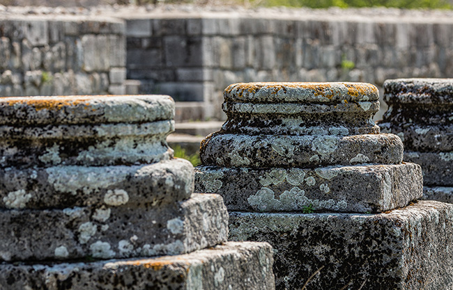
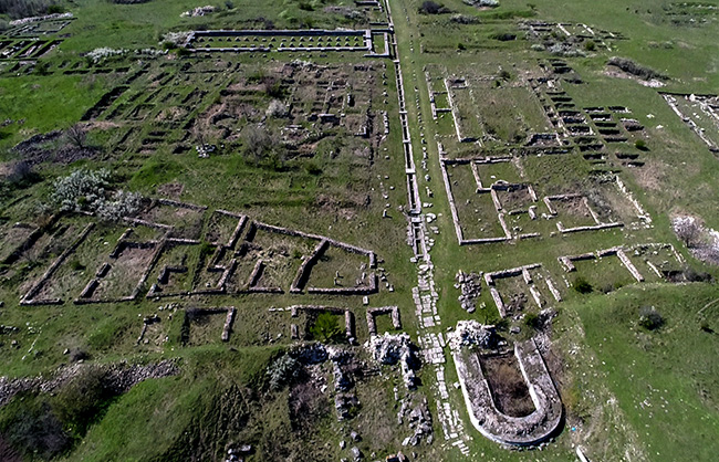
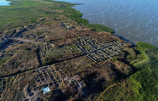
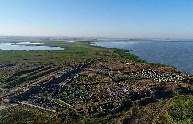
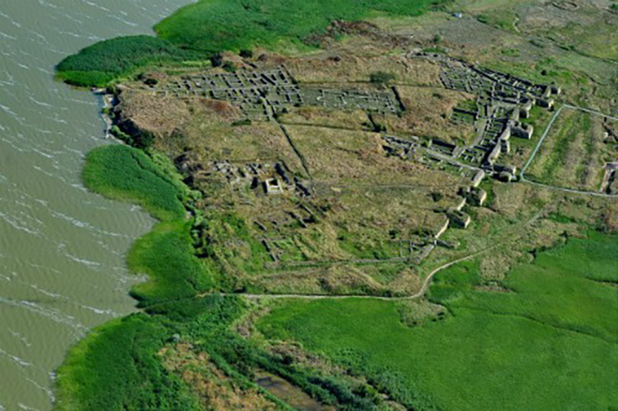
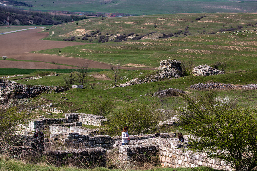
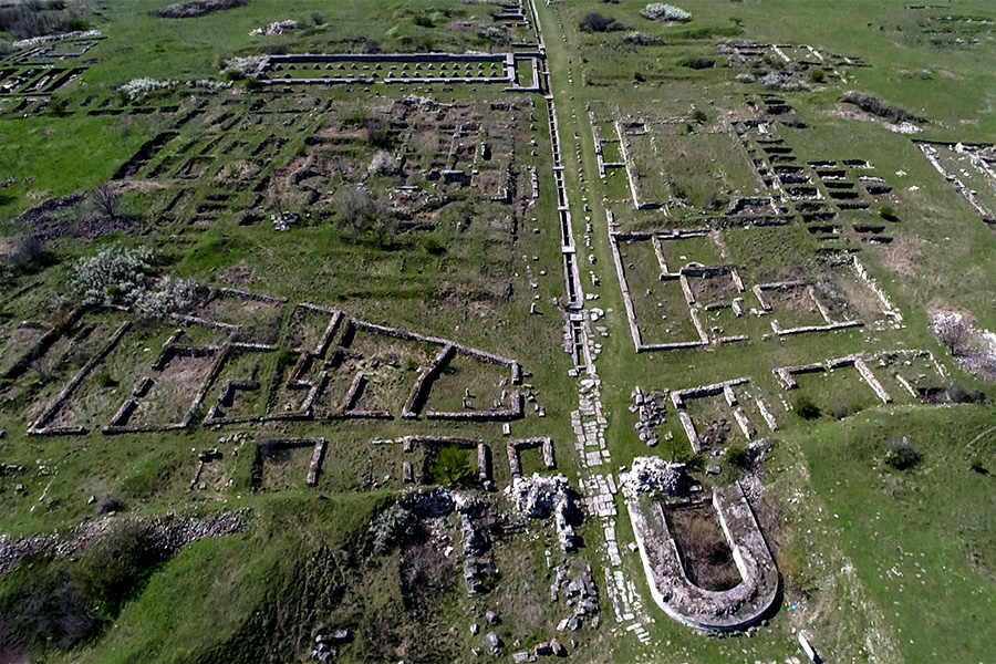
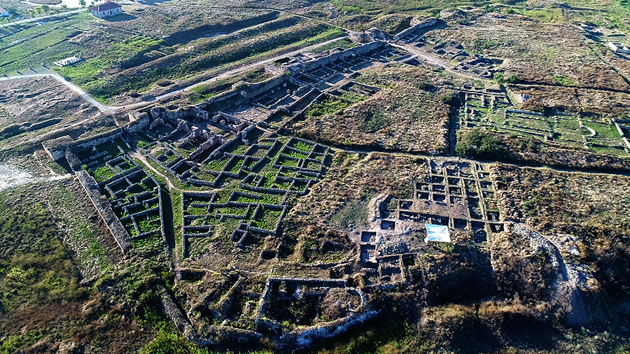
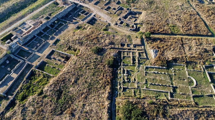
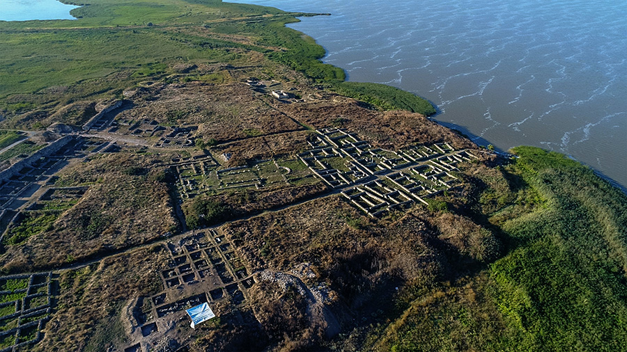
HISTRIA
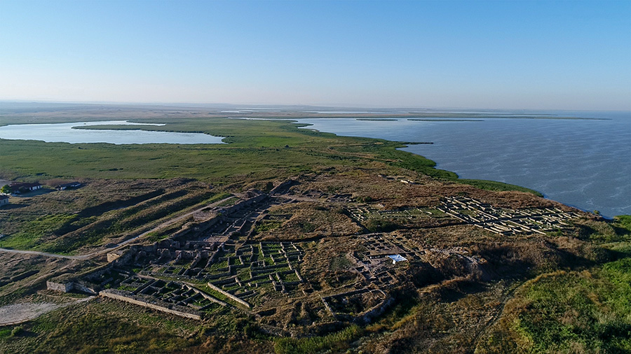
Histria or Istros (Ancient Greek: Ἰστρίη, Thracian river god, Danube), was a Greek colony or polis (πόλις, city) near the mouths of the Danube (known as Ister in Ancient Greek), on the western coast of the Black Sea. Histria is derived from the Latin word "Hister", meaning "Danube", the river the city was located near, and "-ia", a suffix added to a word to signify that it was a location or place, as in Gallia or Iberia. Altogether Histria means "On the Danube", "Located near (or by) - The Danube". It was the first urban settlement on Romanian territory when founded by Milesian settlers in the 7th century BC. It was under Roman rule from the 1st to 3rd centuries AD. Invasions during the 7th century AD rendered it indefensible, and the city was abandoned.
Established by Milesian settlers in order to facilitate trade with the native Getae, it is considered the oldest urban settlement on Romanian territory. Scymnus of Chios (ca 110 BC), dated its founding to 630 BC, while Eusebius of Caesarea set it during the time of the 33rd Olympic Games (657 – 656 BC). The earliest documented currency on Romanian territory was an 8-gram silver drachma, issued by the city around 480 BC.
Archaeological evidence seems to confirm that all trade with the interior followed the foundation of Histria. Traders reached the interior via Histria and the Danube valley, demonstrated by finds of Attic black-figure pottery, coins, ornamental objects, an Ionian lebes and many fragments of amphoras. Amphoras have been found in great quantity at Histria, some imported but some local. Local pottery was produced following establishment of the colony and certainly before the mid-6th century. During the archaic and classical periods, when Histria flourished, it was situated near fertile arable land. It served as a port of trade soon after its establishment, with fishing and agriculture as additional sources of income. By 100 AD, however, fishing had become the main source of Istrian revenue.
Around 30 AD, Histria came under Roman domination. During the Roman period from the 1st to 3rd centuries AD, temples were built for the Roman gods, besides a public bath and houses for the wealthy. Altogether, it was in continuous existence for some 14 centuries, starting with the Greek period up to the Roman-Byzantine period. The Halmyris bay where was the city founded was closed by sand deposits and access to the Black Sea gradually was cut. Trade continued until the 6th century AD. The invasion of the Avars and the Slavs in the 7th century AD almost entirely destroyed the fortress, and the Istrians dispersed; the name and the city disappeared.
Geographic setting
Ancient Histria was situated on a peninsula, about 5 kilometres (3 mi) east of the modern Romanian commune of Istria, on the Dobruja coast. The ancient seashore has since been transformed into the western shore of Sinoe Lake, as the Danube's silt deposits formed a shoal which closed off the ancient coastline. The current Sinoe Lake was at the time the open northern bay, while another bay on the southern shore served as the port. The acropolis with sanctuaries was established on the highest point of the coastal plain. The settlement itself, erected in the 6th century, was 1/2 mile (800 meters) to the west of the acropolis. The settlement had stone paved streets and was protected by strong wall. Water was collected along 12.5 mile (20 km) long aqueducts.
The ruins of the settlement were first identified in 1868 by French archaeologist Ernest Desjardins. Archaeological excavations were started by Vasile Pârvan in 1914, and continued after his death in 1927 by teams of archaeologists led successively by Scarlat and Marcelle Lambrino (1928–1943), Emil Condurachi (1949–1970), Dionisie Pippidi, Petre Alexandrescu and Alexandru Suceveanu. The Histria Museum, founded in 1982, exhibits some of these finds.
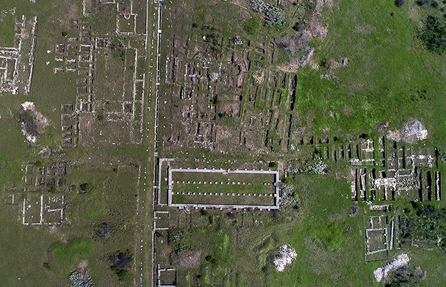
TOMIS
Approaching the ancient city of Tomis - heart of modern Constanta - from the south, the easily defensible peninsula is clearly defined, crowned by the metallic domes of its modern Orthodox cathedral, and the minaret of the Carol I or Great Mosque. Along the western flank, largely intact Roman walls rise above the old Roman harbour administrative buildings, baths, and mosaic. In the middle of the peninsula is Piata Ovidius, the old city centre, and Ovid's statue.
Archaeological evidence dates the earliest Greek settlement on the peninsula to f around the sixth century BC. Initially, Tomis was just a trading post between Scythia and resident Geto-Dacian populations, but later became a colony in its own right, whose rise in importance brought the erection of elegant public buildings and private dwellings in stone and marble.
In 72-71 BC the Romans invaded and subsequently occupied most of the Greek colonies on the western shore of the Black Sea. But after approximately 10 years, assisted by the local populations, these colonies rebelled against the Romans who, following a heavy defeat near Histria, were forced to withdraw from the region. Soon after, around 55-48 BC, taking advantage of the ongoing political instability, Burebista, the Dacian king, brought the colonies under his rule. This was short-lived, though; in 44 BC Burebista died, and by 28- 27BC the Romans had regained control of the region, Tomis and its surrounds included. Some of the best documentary evidence regarding the subsequent period is provided by the Latin poet Ovid, who lived here in exile between 9-17 AD, writing Hpistulae ex Ponto (Letters from the Black Sea) and Tristia (Sorrows). He is reputed to have been buried at the gate of the city.
In 46 AD Dobrogea became part of the province of Moesia and Tomis became known as the "Glorious metropolis and capital of the Left Pontus". From the 4th to the 7th centuries the city was the capital of the province of Scythia Minor. It was during this period of prosperity - richly represented in archaeological finds - that the mosaic, baths and basilicas were constructed. As early as the third century however, the relative stability of this golden age fell under threat from repeated invasions of Carpo-Goths, and the city saw extensive refortification work which continued until the sixth century.
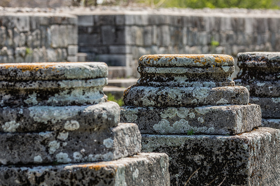
Archeological evidences have established that the Greek arrival and settling in the peninsular area of Constanza took place sometimes in the 6th century B.C., the city of Tomis being at the beginning an emporium (a commercial factoria preceeding the actual constitution of the colony). It was only in the Hellenic epoch (IV-I century b.C.) when the citadel gained the character of a polis. During this period of time the importance of the city was growing, rich possessions being accumulated that offered the citizens the possibility to build elegant public and private edifices of stone or marble, also aqueducts of which a small number can be seen nowadays: columns, framings, friezes, capital fragments etc.. Also in this period of time a defense wall has been built similar to the West Pontic fortresses Histria and Callatis. The citizens organized their social and political lives in resemblance to the Ionian model.
Starting with the 1‘century B.C.. the geopolitical situation of the entire West Pontic area suffers modifications because of the Roman conquest from 72-71. when the Romans take over authority. In 55 B.C. king Burebista becomes the ruler of this region until his death in 44 B.C.
In the first years of Roman ruling the Greek cities assemble to an union, at first five fortresses - Histria, Tomis, Callatis, Dionysopolis (Balcic) and Odessos (Varna)- and later six fortresses - Mesembria (Nesebar). The headquarters of the union was at the beginning in Odessos and later Tomis took over leadership. The military commander of the West Coast of Pontus Euxinus had his headquarters also in Tomis. Reports and hints regarding life in Tomis at the beginning of the 1st century A.D. are to be found in the literary work of Ovid, the Roman poet that was exiled here from 9-17 A.D. by emperor Octavian Augustus. Tomis became a second home to the miserable from Sulmo who died here in 17 A.D. and was buried according to late literary testimony at the fortress gate - ante oppidi portam. A long series of administrative rules follows culminating in the formation of the Moesia Minor province (this province coincides on the whole with today’s Dobruja) in 86 A.D., during the reign of emperor Domitian. Tomis becomes the province residence in the 2nd century A.D. and will grow and urbanistically expand as no other citadel from the Left Pontus had expanded during the Roman reign. Beginning with the 3rd century A.D. the pax romana is constantly disturbed by the invasions of the carpo- Goths thus considerably prejudicing the life of the citadel Tomis which was referred to in the testimonies of the time as "the brilliant metropolis and capital of the Left Pontus". At the end of the 3rd century A.D. and in the centuries to follow until the reign of emperor Justinian (527-525) great efforts were made in order to rebuild the site wall. The Diocletian reforms established a new structure in the administrative, military and financial system of the empire. From that point Dobruja was given the name of Scythia Minor, the capital being at Tomis. During this historical situation the city of Tomis gained new impulses. The beauty of the city was improved by new public and private edifices, the harbor activity intensifies due to the fact that from the 4th century a.D. Tomis bordered upon the new capital of Constantinople. How important the brilliant metropolis has been from the 4th-7th century A.D. is proved by the Roman mosaic Edifice, the thermae and numerous other discoveries - coins, ceramics, inscriptions, architectural and sculptural fragments.
The spiritual importance of Tomis has been developing when the Christian religion became official in the empire during the reign of emperor Constantine the Great (306- 337). Historical sources mention many bishops- Gerontios, Theotimos, Timotei, loan etc. while archeological sources refer to numerous sumptuous ornamented basilica, with fretwork windows, columns and capitals with cross and rosette ornaments.
From a political and military point of view the period from the 5 th- 7th century A.D. has had serious implications upon the life of Tomis as well as upon the whole region. The invasions of the migratory people had started : the Huns, the Slavs, the Protobulgarians. These invasions have determined a backing off of the Byzantine administration from the region for a longer period of time. The city of Tomis has been destroyed and in such a situation life became rural in the former citadel. The Byzantine reign in Dobruja has been reinforced only in 971 when the powerful emperor loan Tzimiskes (969-976) had abolished the Bulgarian czarist reign and the region between the Danube and the Black Sea had been organized as a thema (a Byzantine administrative and political division) named Paristrion with the capital at Durostolom (Silistra).
During the Byzantine period (8th-12th century) Tomis has been known as Constantiana or Constantia, named supposedly after a district of Tomis. This district got its name after some members of the imperial family in the 4th century A. D. The present name of Constanta derive from Constantiana or Constantia as Byzantine and medieval Italian records state. Also the not interrupted usage of this name certifies the continuous existence of the local population that was romanized on the territory of the old citadel and surroundings.
We now present the most important sightseeing edifices of the old Tomis from north to south as follows: the Inner Wall of Tomis, situated along the Ferdinand Bulevard, the Roman Mosaic Edifice situated in the Ovidius Square, the Thermae situated on the western cliff near the first harbor entrance, the Ancient District in the Cathedral’s Parc with 12 archeological levels that cover a period of almost a millenium in the history of the Tomis citadel thus proving an material existence of Tomis in the 6 century B.C. j
Numerous archeological evidence of ancient Tomis are exhibited at the National Museum of History and Archeology in Constanta, 12 Ovid’s Square.
>>Legends of the Black Sea
>>Muzeul de Istorie Națională și Arheologie Constanța (Museum of National History and Archeology Constanta)